When I was 19, I was a ski bum in Vail, and I would run home at night under the stars, with the moon illuminating the Gore Range in front of me and the dry snow crunching under my feet. It was about a five-mile run from Lionshead back to the house in East Vail.

The Gore Range is visible from all over Vail, whether you’re skiing, walking in town, or driving on I-70. The Gores are the iconic postcard shot. However, they are not part of the town of Vail. They’re not part of Vail Resorts. They are the great wilderness backdrop that Vail aura farms.
Table of Contents
- Part I: Nineteen years-old with a one-way ticket to Vail, no job, no house, and no plan
- Part II: Returning to Vail for the first time in 30 years, failing to summit Grand Traverse, and my daughter heads to CU Boulder
- Part III: Bucket list trip to Vail 32 years later with Rori
- Part IV: Attempting to summit Grand Traverse Peak with my daughter
- Part V: Reaching the top of Grand Traverse Peak!
- Part VI: A photo guide to summiting Grand Traverse Peak from Deluge Lake for non-technical hikers
- Part VII: Celebrating with a gondola ride and a sentimental walk around Vail
- Part VIII: Meeting a kindred spirit by chance – an EPIC Gore Range moment
- Part IX: Recreating a few fun 1994 memories with photos
- Part X: Saying goodbye to the Gore Range and closing a chapter
In this post, I’ll share photos of our hike to the top (the first part is here), but I’m also going to give a detailed account separately of what it’s like to get there and the best route to take. A lot of locals and ski bums have Grand Traverse Peak on their bucket lists, because the mountains call them from every angle when they live in Vail. In my separate post, there is hopefully more than enough ‘beta’ and descriptions to help even non-technical folks get to the top. The hike is not too difficult. But there is no trail, and it’s intimidating. A second climb would be 40x easier than a first, simply for familiarity.


Deluge Lake sits at 11,746 feet, and Grand Traverse is 13,063 feet. The way up to the top of Grand Traverse was new territory because I had never scrambled without a trail, and I was nervous about the conditions. It’s a one-mile climb up a rock field that is deceptively long because of the scale of the mountains. I had researched the route as best I could, but I made a mistake and went too far to the left. I’ll put lots of info in the second post that explains everything you need to know.
The hill of rocks leading up from the lake is a 60-degree slope, and even the grassy portions are intimidating. Throughout the ascent, we saw quite a bit of fresh mountain lion poop. If Rori had not been there, I would have turned around. There were some really cute pika squeaks around us too (but we didn’t see them).


Once we reached the crest, we had to climb a half-mile boulder field to the summit. The official USGS term is felsenmeer, or “sea of rocks.” There was an incredible amount of loose talus, and stones would fall hundreds and hundreds of feet if you knocked them loose.
The forecast had a 75% chance of rain and lightning at 11 AM, and we reached the summit at 10:15 AM. I never thought I’d make it to the summit because of logistics and finances. It literally didn’t seem like something that could happen outside of my daydreams.


When we got to the top, I shed a few tears of joy, and then it was all smiles as Rori and I realized we were literally looking down on I-70 and could see the frontage road I had run every night 33 years ago. We could see the Nordic Center. We could see the golf course. We could see Vail Village. I was overwhelmingly happy to share the moment with Ro.


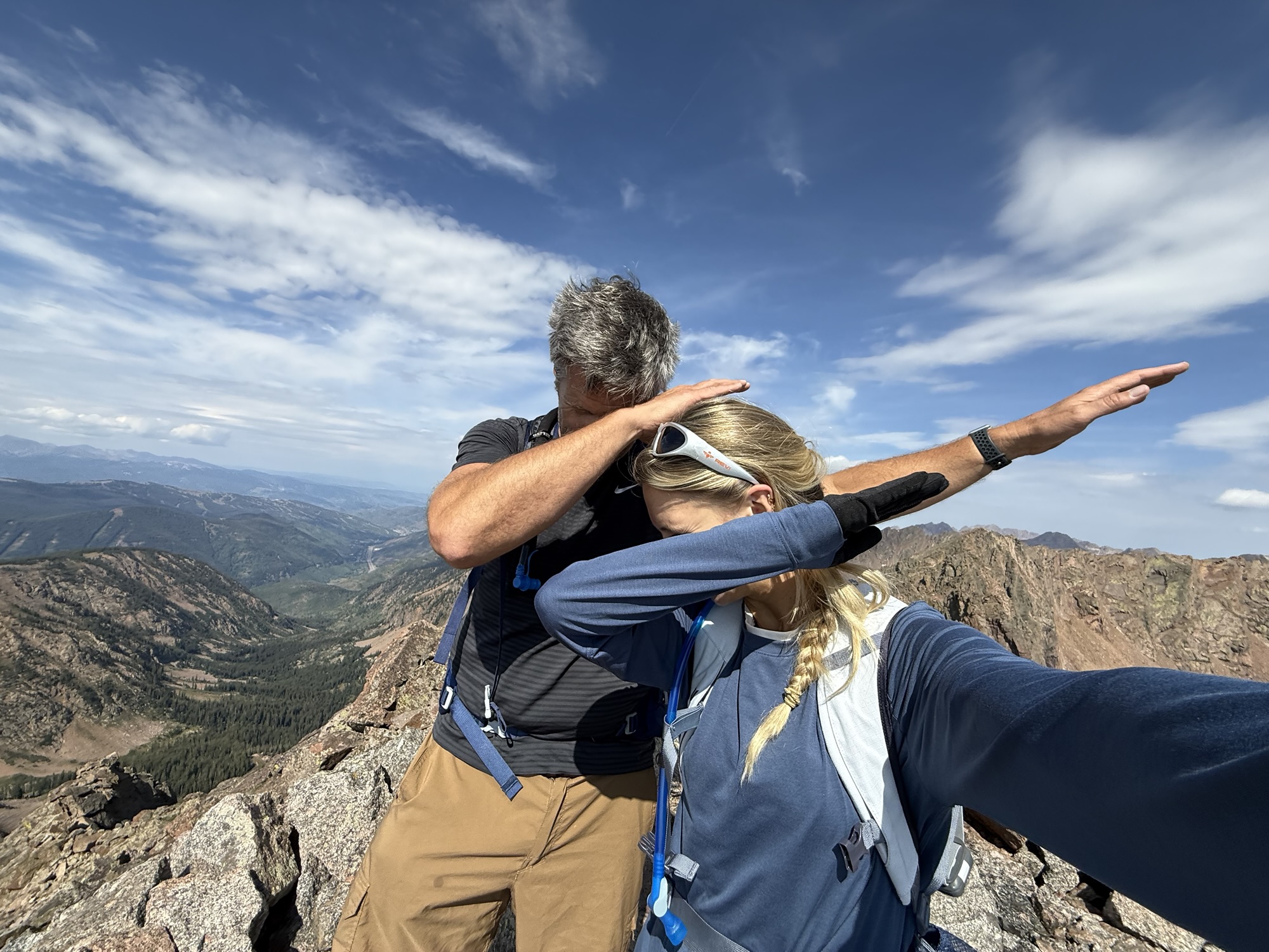
Before Rori went to college, we got matching YOLO tattoos, and in the spirit of things, I added Grand Traverse Peak to my tattoo. Rori had the great idea to take a picture of our tattoos together.

We dabbed and then began the quad-crushing, jellifying, muscle-destroying descent through what felt like endless rocks.

On the way down, we chose a much better route and crossed the talus at the very bottom. We ran into a family of mountain goats: a mom, dad, and little baby. The mountain lions chirped and got incredibly close to us, to the point where I couldn’t figure out how I didn’t see them. Rori and I pretended we owned the place and tried to be as casual as possible until we descended back into the tree line.
Living at the beach and knowing we swim with sharks all the time, I decided to trust the statistics, and luckily, we did not become one. It was smooth sailing and joy, and the rain held off until 2 PM.
At 3:15 PM, about 11 hours after we started, we got back to the trailhead. After 33 years, words really can’t describe how emotional it was to finally achieve something so sentimental and meaningful. Sharing it with Rori made it even more special.
Getting this accomplished has allowed me to finish a story that started when I was 19. Reaching the peak of Grand Traverse was a top-five moment of my life. I hope Rori and Chloe can go up together someday, and if they’re up for it, I’ll do it with them and Jen. Now I’m ready to do new things together instead of looking backward.

Here are the photos from the way down from the summit of Grand Traverse!


Table of Contents
- Part I: Nineteen years-old with a one-way ticket to Vail, no job, no house, and no plan
- Part II: Returning to Vail for the first time in 30 years, failing to summit Grand Traverse, and my daughter heads to CU Boulder
- Part III: Bucket list trip to Vail 32 years later with Rori
- Part IV: Attempting to summit Grand Traverse Peak with my daughter
- Part V: Reaching the top of Grand Traverse Peak!
- Part VI: A photo guide to summiting Grand Traverse Peak from Deluge Lake for non-technical hikers
- Part VII: Celebrating with a gondola ride and a sentimental walk around Vail
- Part VIII: Meeting a kindred spirit by chance – an EPIC Gore Range moment
- Part IX: Recreating a few fun 1994 memories with photos
- Part X: Saying goodbye to the Gore Range and closing a chapter

Leave a Reply